Territorial resilience strategy in l’Horta Sud
l’Horta Sud, Valencia · Spain · 2024–2029
Technical data
- Client
- Municipios de l’Horta Sud
- Period
- 2024–2029
- Type of intervention
- Flood-risk mitigation
- Scale
- Basin · supra-municipal scale
- Studio role
- Territorial diagnosis, technical strategy, coordination and definition of actions
- Scope of work
- Picassent ravine and the southern metropolitan area of Valencia
- Status
- Design and execution
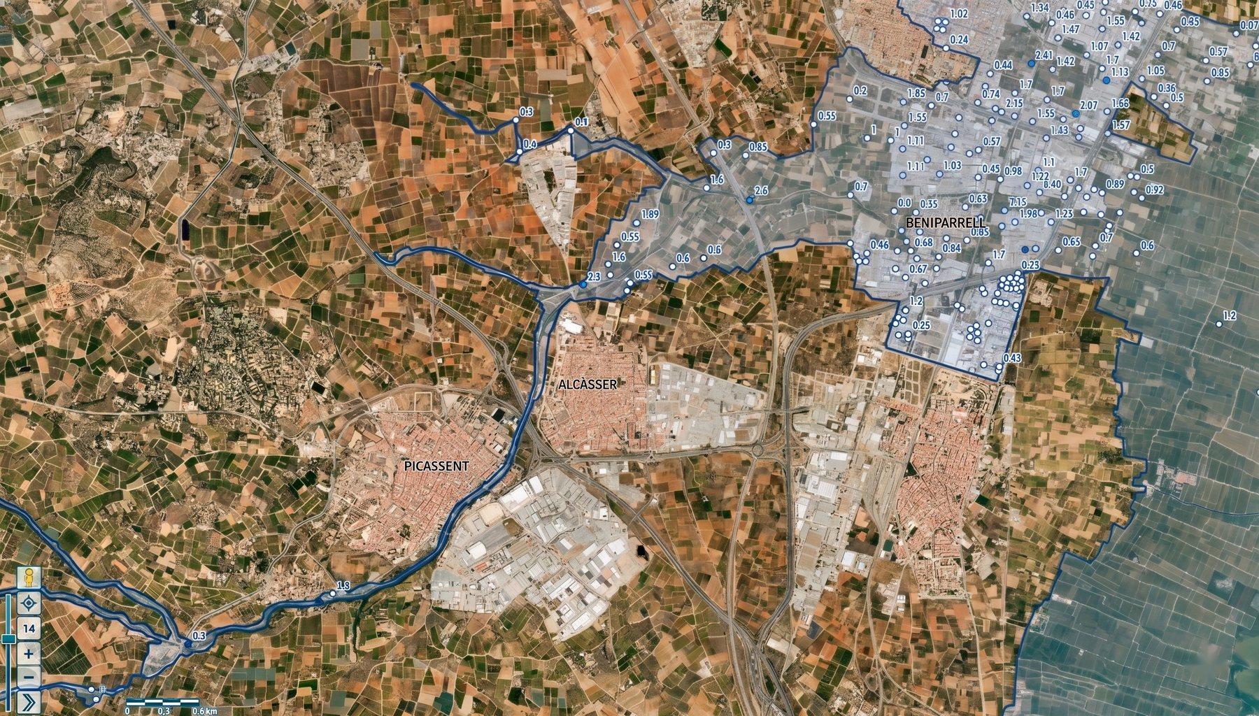
Description
Ongoing technical work for municipalities of l’Horta Sud affected by the November 2024 DANA, focused on the territorial, hydraulic and urban analysis of the area around the Picassent ravine.
The event exposed the vulnerability of certain urban centres located where channels, infrastructure and runoff from several sub-basins meet. At some points, the concentration of flows caused water to partially enter urban areas; downstream, the accumulation of flow produced very severe impacts on the residential, productive and community fabric.
The strategy addresses the problem at a basin scale, combining territorial diagnosis, flood-attenuation criteria, improvement of hydraulic capacity, removal of critical points and the definition of spaces able to take on water in a controlled way.
The aim is not only to reduce the risk of future extreme events, but to transform the hydraulic corridor into a blue-green infrastructure: a system of protection, landscape, soft mobility and public space serving the territory.